Georeferenced Polygon Terms | ||||
|
| |||
Properties of a Valid Georeferenced Polygon
To describe the boundaries of boreholes in the Geoscience Interpretation app, you can
define the geospatial boundaries of the boreholes using a geometric feature. In the
workspace of the app, you can add the feature that consists of vertices with appropriate
geospatial position that also displays the surveyed boreholes. You can define the boundary
of the edges of the geometry of an area and any borehole whose collar location is located
within the area. You can only use a geometry artefact that is not two distinct
polygons.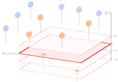
You can create a valid georeferenced polygon that can be used in a GDS query if the polygon:
- Contains a single and distinct polygon.
- Contains only one ring.
- The ring is closed (that is, the first and last points are the same).
- The ring contains at least four points (a minimum polygon is a triangle with the same first and last points.)
| Term | Description |
|---|---|
| Georeferenced polygon |
A geometric feature containing geospatial information that you can use to highlight an area of interest. |
| Surpac | An application that is used in various mining and geology processes. |
| SDMv2 file format | A file format for geometry exported from Surpac. For the SDMv2
file format, apply a CRS (coordinate reference system) to the SDM file, before using
it in a query. Note:
Geometry with a single object containing a single segment is
supported.
|
| WKT file format | Well-Known Text, a file format for specifying geometry. If you cannot import an existing georeferenced polygon, you can use the WKT format to describe the constraining shape. |