Previewing Surpac SDM and STR Files

You can preview Surpac Data model (.sdm) files and Surpac STR (.str) files in your experience from 3DSpace or 3DSearch.

SDM files were designed to include the contents of the previously used Surpac .str , .dtm , and .ssi files. STR files contain strings defining point coordinates for geological data (such as terrains).

For more information, see Geology Modeling: Data Import and Organization: SDM files.


Before you begin:
  • You must be granted the GEX (Earth Contributor) role.
  • These files are intended for preview only, they are not saved in the experience.
See Also
Add Objects from 3DSpace or 3DDrive
  1. From the Compass, click Social and Collaborative Apps , then drag the 3DSpace widget to your dashboard.
  2. From 3DSpace, drag the .str or .sdm file to your experience.
    • If geolocation information has been provided in the SDM file, the geometry is automatically projected in the CRS defined in the referential.
      Important: If no length unit has been specified in the file, the meter (m) is used by default.
    • The geometry is positioned at the origin (0, 0, 0 coordinates) of the slab's CRS.

    The Robot is snapped to the data to help you relocate it.
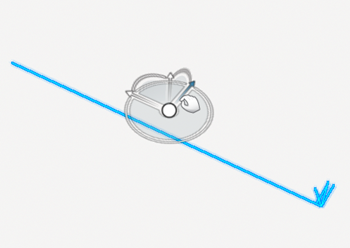
    In the tree, a new group is created under the Temporary Items folder.

    Tip: Right-click the group corresponding to the loaded geometry, and then select Move to Loaded Items to position the camera directly on the loaded geometry.
  3. Use the Robot to modify the geometry position.
    The arcs on the planes and the planes themselves are highlighted as you point to them.

    You can:

    • Pan along the direction of any axis of the Robot.
    • Rotate in a plane.
    • Pan in a plane.
    • Rotate freely about a point on the Robot.

    To deactivate the Robot, click Edit Mode .