Displaying Coordinates Information | ||
| ||
-
From the
View section of the
action bar,
click
Information
 .
.
-
Move your mouse over your experience.
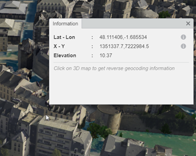
The Information panel displays coordinates information that is automatically updated each time you hover over an object.
Coordinates are displayed according 2 Coordinate Reference Systems. To show this information, hover over the
 icon:
icon: - EPSG 4326 for latitude and longitude (as with a GPS).
- EPSG code of the associated CRS.
Elevation information is displayed in absolute coordinates, or relative to the ground mode. "Relative to the ground" means that the object you point at is not on the ground.

-
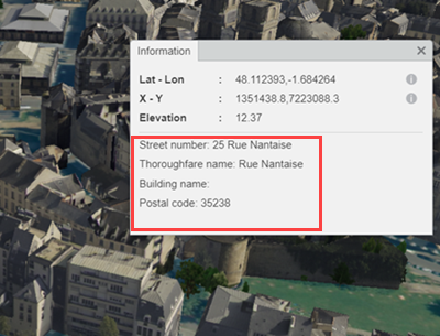
Click a point in the 3D area.
Reverse geocoding information (that is, the address that is closest to the clicked point) is displayed in the bottom part of the Information panel.
More precisely, reverse geocoding associates an address to geographic coordinates, which makes the identification of locations easier.

Important: Reverse geocoding must have been previously defined through a BAP (Building Address Points) document, for example.