Colorizing a Terrain | ||
| ||

-
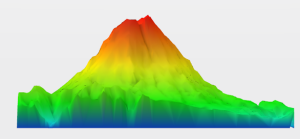
Select a terrain mesh.
The color shading is automatically applied according to the surface elevation from the minimum height value identified in blue up to the maximum height value identified in red. These values are called represented by rated points.
 Note: You can select multiple elements at a time, the elevation of the selection set is accounted for in the calculation.