-
From the
Author section of the
action bar,
click
Create Plane to Point Measurement
 . .
-
Move your mouse over a location.
The X, Y, and Z coordinates of the plane are displayed. 
-
Click the place to be used as the reference plane for measuring.
-
Move to the end point, press and hold down the right mouse button
for 2 seconds, and then release.
A label displays the distance between the plane and the clicked point. 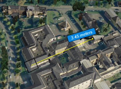
-
Click the label then use the
Properties panel to modify properties as needed.
-
Repeat these steps as many times as necessary to create
additional measures.
-
To remove a distance label, select it then press
Delete.
|