Refining a Terrain | ||||||
|
| |||||
-
From the
View section of the
action bar,
click
 , and select triangles.
-
From the
Prepare section of the
action bar,
click
Refine Terrain
 .
The Refine Terrain dialog box appears. In this dialog box, a Survey check box is available to flag points as survey points, and two other check boxes, Threshold and Direction, allow you to complete the refine operation.
.
The Refine Terrain dialog box appears. In this dialog box, a Survey check box is available to flag points as survey points, and two other check boxes, Threshold and Direction, allow you to complete the refine operation. -
Select the
Threshold check box and specify a threshold
value.
 By default, The value is set to 10mm.
All points that are greater than 10mm are ignored in the refine calculation.
-
Select the
Direction check box.
By default, the direction in the projection along the
normal of the triangle.
-
Select a terrain mesh.
A dedicated terrain label appears. It displays the terrain's name and provides option buttons for modifying the terrain:
-
 : To clear the selection.
-
 : To hide or show the terrain.
Note: If you select a terrain that contains survey points, the survey points are displayed with their symbol and color. -
-
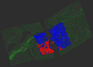
Select clouds.
Important: You can select multiple clouds at once. A dedicated cloud label appears. It displays the cloud's name and provides option buttons for modifying the cloud:
-
: To remove the cloud from selection.
-
: To hide or how the cloud.
-
If the computation is successful, you can run a deviation
analysis to compare the terrain mesh (To Measure) and
the resulting surface (Reference).